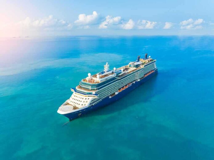
Turning the SS United States into an artificial reef was not a stunt but a tightly choreographed engineering, environmental, and tourism project that fused a singular artifact of American maritime history with a long-running Gulf strategy: build complex structure on a barren seafloor to concentrate life and draw people and capital to the coast.
The Short Version
- Officials executed a planned, valve-controlled sinking of the 990-foot SS United States to create a large artificial reef offshore of Destin–Fort Walton Beach.
- Deployment coordinates were publicly published in advance; a post-deployment survey will establish final position, depth, and orientation.
- The reef is designed as both habitat and a marquee dive/fishing destination, backed by county leadership and dedicated tourism funding.
- Florida’s artificial reefs have a documented record of attracting recreation and economic activity; ecological performance will be established over time.
What Was Done: A Planned Offshore Sinking With Publicly Filed Coordinates
The SS United States—at 990 feet, the largest passenger ship ever built in the United States—was deliberately sunk as a reef after an orchestrated offshore operation southwest of Destin–Fort Walton Beach. Okaloosa County publicly noticed the deployment and framed it as the World’s Largest Artificial Reef, specifying a target site roughly 22 nautical miles offshore, with proposed coordinates 30° 07.148′ N, 86° 46.755′ W. The operation followed a familiar large-ship reefing playbook: prepare the hull, tow to the permitted area, and initiate controlled flooding through pre-cut openings and valve sequences to settle the ship onto the seafloor. Contemporary coverage tracked the moment valves were opened to begin the descent, a normal marker in reefing operations that balances stability, safety, and final orientation goals.
Large deployments of this kind are communicated with both a planned position and a commitment to conduct a post-sinking survey; the latter is what fixes the definitive latitude/longitude, hull attitude, and depth for charts and dive briefings. Organizers were explicit that final coordinates would be published after survey, a standard step that separates the operational target box from the wreck’s actual resting point once currents, winds, and the ship’s hydrodynamics during downflooding play out.
Why A Ship Reef Here: Habitat, Diving, And A Recognizable Flagship
The northern Gulf’s sandy shelf offers vast expanses of low-relief bottom; complex vertical structure is scarce. Artificial reefs—pyramids, concrete modules, and, at the top end, ship hulls—insert three-dimensional habitat that interrupts flow, creates eddies, and offers shade lines and ambush points. Pelagic predators cruise edges; bait consolidates in the lee; sessile organisms encrust steel and aluminum. The SS United States, for all its cultural baggage, is simply an enormous, durable lattice in that ecological sense—a platform meant to recruit invertebrates first, then forage fish, then the larger guilds that interest both ecologists and anglers. County materials and coverage emphasized the dive and fishing draw and anticipated species from groupers and snappers to highly mobile tunas and mahi, echoing long-observed patterns at other Panhandle wrecks.
Local governments do not pretend this is ecology in a vacuum. Tourism partners put real money behind the attraction: Escambia County’s tourism authority publicly committed $1 million toward deployment and $500,000 annually for five years to market the site—a recognition that marquee wrecks change trip calculus for divers and charter operators across a region. The SS United States sits within reach of the USS Oriskany—another large-ship reef—turning Northwest Florida’s offshore corridor into a multi-stop destination for advanced divers and offshore captains.
How The Mechanics Work: Preparation, Downflooding, And Survey
Reefing a ship is equal parts naval architecture and environmental compliance. Before tow-out, contractors strip polychlorinated biphenyls (PCBs) where feasible, oils and fuels, floatables, and loose interiors; they cut and reinforce access points to promote a stable, predictable flood pattern while preserving strength in key frames and decks. On station, the tow team aligns within the permitted grid, checks weather, and sequences the sinking—valves open, internal compartments equalize, trapped air vents to avoid explosive bubble release, and the hull rotates to its final heel/trim as buoyancy disappears. The aim is a controlled, low-energy touchdown that preserves structure, minimizes bottom scour, and reduces the chance of a list that would complicate diving or diminish vertical relief. Only after the hull settles do operators run multibeam sonar and visual confirmation (ROV or diver) to nail down coordinates, depth, and orientation for Notices to Mariners and dive briefs.
Scale matters. At 990 feet, the SS United States offers colossal linear habitat and the chance for shallow-to-deeper depth zones along a single hull, important for both ecological niche variety and diver route planning. Organizers described it as the world’s largest artificial reef by length; while the claim rests on the ship’s extraordinary size, definitive ranking awaits a consistent measurement standard across reef ships—length, displacement, or wetted surface are different yardsticks with different implications.
What Florida Already Knows About Artificial Reefs: Use And Economic Gravity
Florida has run one of the nation’s most extensive artificial-reef programs for decades. Independent economic analyses consistently find that fishing and diving on these reefs support substantial regional activity; one NOAA-linked synthesis estimated that reef-related recreation in Florida supports roughly 39,000 jobs and $3.1 billion in output in an impact model, a reminder that the draw of structure in open water translates into charter bookings, hotel nights, and fuel docks ringing cash registers on shore. County-level studies and Sea Grant-backed surveys in southwest Florida have reported similar dynamics at a smaller scale, with artificial reefs functioning as dependable trip anchors for private boaters and for-hire fleets.
None of that replaces the need for site-specific monitoring. It does, however, establish why counties compete to sponsor high-profile deployments and why tourism agencies are willing to market a wreck the way a museum markets a new wing. A named hull with a storied past commands attention; attention converts to trips; trips, reliably, become local economic impact.
The Heritage Question: Honoring A Record-Setter By Changing Its Medium
The SS United States is not an anonymous hull. Launched in 1952, she set the still-standing transatlantic speed record for an ocean liner and sailed as a Cold War icon. That history traveled with the tow: coverage emphasized her record, the luminaries who sailed aboard, and the preservation of signature components like the funnels for topside display. Reefing, in that frame, becomes an act of conversion rather than erasure—relocating a national artifact from pier-side decay into an underwater gallery that only trained divers will visit, while a land-based museum interprets the story for everyone else.
Projects of this profile do traverse formal review. Reporting noted a nonprofit lawsuit filed to challenge federal environmental and historic-preservation processes—litigation that targeted permits and a finding of no significant impact rather than alleging post-sinking harm. The case underscored how reefing often has to satisfy multiple, sometimes conflicting constituencies: fisheries managers, dive safety advocates, preservationists, and coastal business coalitions.
What Comes Next: Survey, Science, Safety, And Stewardship
From here, four milestones define success. First, the post-deployment survey: publish final coordinates, depth, and hull attitude so charts, dive guides, and operators can plan with precision. Second, an ecological baseline and a monitoring arc; colonization follows a familiar succession, but the only way to judge net benefit is to measure fish abundance, species mix, and benthic cover against control sites over time. Third, visitor management and safety: a wreck of this size in offshore conditions demands disciplined training standards, emergency planning, and strong briefings—areas where the region already benefits from organizations such as Divers Alert Network and experienced charter fleets. Fourth, heritage interpretation topside: the saved artifacts and planned museum exhibits will determine whether the ship’s cultural value remains broadly accessible or retreats entirely underwater.
Sources:
youtube.com, myokaloosa.gov, rgj.com, staugustine.com, abcnews.com, providencejournal.com, 6abc.com, visitflorida.com, detroitnews.com, repository.library.noaa.gov, journals.flvc.org
© impactheadlines.com 2026. All rights reserved.